

Localization
Introduction
The Localization feature allows the user to identify the position and orientation (pose) of one or more sensors within a pre-existing 3D point cloud map. While SLAM is used to map an unknown area, localization is used when you already have a map and need the sensor to navigate or track its movement relative to that map 3D point cloud map.
By using the Ouster SDK, you can achieve high-precision, high-frequency pose tracking without needing to implement complex point-cloud registration from scratch. The SDK handles motion compensation, multi-sensor fusion, and frame-to-map alignment, exposing them through a simple CLI command and a programmatic Python/C++ API.
Localization does not require GPS, GNSS, or other expensive secondary sensors. A single Ouster LiDAR can be used by SDK to reliably estimate the sensor’s position based entirely on relative pose changes within the environment.
Typical applications include:
Autonomous mobile robots (AMR): Continuous pose tracking for navigation and path planning inside warehouses, factories, or other structured environments.
Fleet operations: Multiple vehicles sharing a single reference map, each independently localizing against it.
How it Works
The SDK’s localization engine uses an Iterative Closest Point (ICP) approach to match frames with the map. The key difference from SLAM is that the internal map uses a static map constraint. The engine loads a pre-built point cloud once at construction time and never modifies it. Each incoming batch of lidar frames is aligned to this fixed reference to determine where the sensor is.
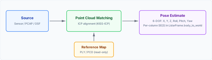
Source data is aligned against a static reference map using ICP. The map feeds into point cloud matching
as a read-only input. The output is a per-column SE(3) pose written into each LidarFrame.
At the heart of the engine is frame-to-map registration using Iterative Closest Point (ICP). For each incoming frame the algorithm:
Finds the nearest neighbor in the static map for every live frame point (via a voxel hash map for fast lookup).
Computes the rigid transformation (rotation + translation) that minimizes the sum of squared distances between the matched pairs.
Applies the transform and repeats until the change falls below a convergence threshold (up to 50 iterations).
The result is the sensor’s pose in the map frame.
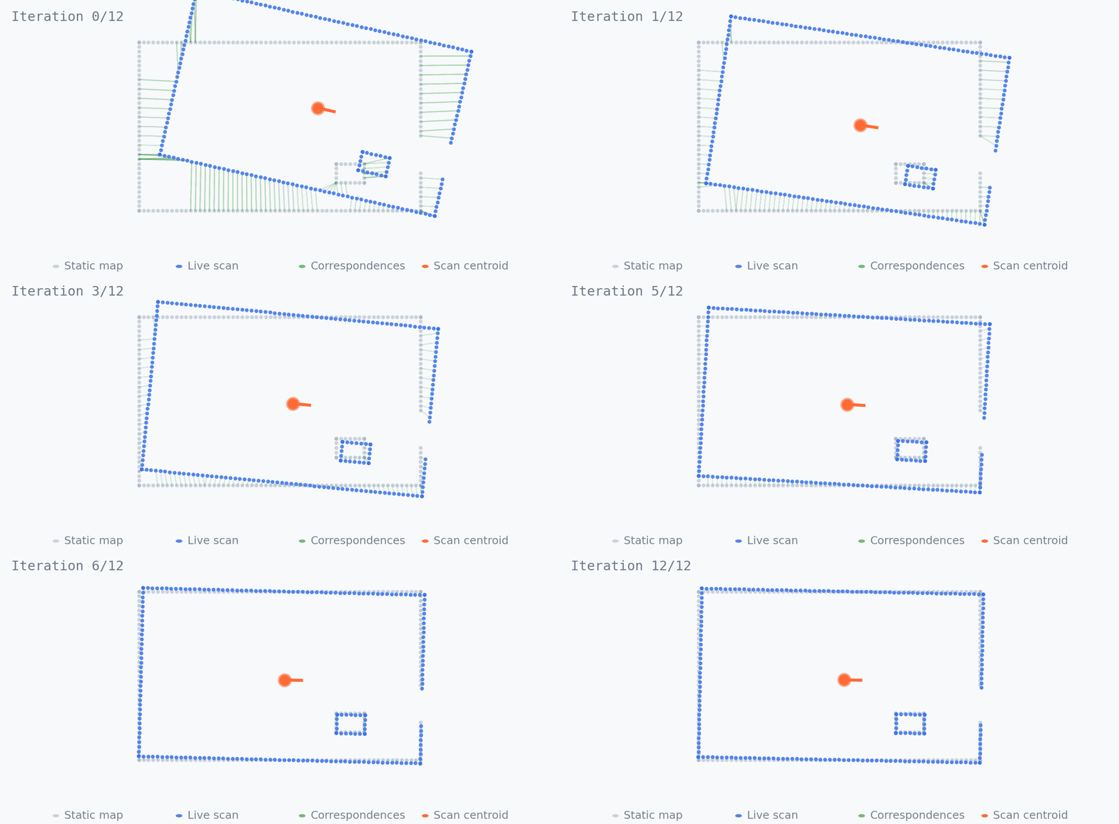
ICP alignment: the cyan frame (source) rigidly slides into the white reference map (target) over successive iterations. Green lines show per-point nearest-neighbor correspondences used to solve each rigid transform.
SLAM vs. Localization
Both SLAM and Localization use the same underlying ICP registration, but they serve different purposes. SLAM explores an unknown environment and builds a map as it goes; Localization assumes the map already exists and focuses on tracking the sensor within it.
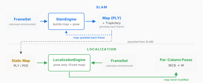
SLAM vs Localization workflow summary
Aspect |
SLAM |
Localization |
|---|---|---|
Map |
Built incrementally from live frames |
Loaded from a pre-existing file (PLY or PCD) |
Map updates |
New points are added each frame |
Map is fixed; no points are added |
Use case |
Exploring and mapping an unknown environment |
Tracking pose in a known environment |
SDK class |
|
|
Key Capabilities
Frame-to-Map Registration: The
LocalizationEnginealigns live point clouds against a pre-built map using Ouster SDK’s iterative closest point solver, estimating a precise rigid transformation each frame.Motion Distortion Correction: Configurable deskewing compensates for sensor motion during a frame. On FW >= 3.2 the engine can use IMU data for higher-fidelity correction; on older firmware it falls back to a constant velocity deskew model.
Multi-Sensor Support: The engine accepts frames from multiple sensors simultaneously, aggregating their points into a single frame before registration. This provides a wider field of view and improves robustness in feature-poor environments.
Per-Column Pose Output: Rather than a single pose per frame, the engine computes a unique SE(3) transform for every measurement column, enabling sub-frame trajectory precision for high-speed motion.
Custom Solver Integration: The SDK can serve as a data provider — use
XYZLutto convert frames to Cartesian point clouds for your own solver, then inject poses back into the frame for downstream visualization and recording.Flexible Map Input: Maps in PLY or PCD format are loaded directly. A typical workflow is to run SLAM first, export the accumulated point cloud, and reuse it for localization indefinitely.
Getting Started
See Using the CLI for the quickest way to run localization from the command line and to see visualization options.
For programmatic integration, see Using the API which covers configuration, engine construction, the processing loop, and using a custom localization solver in both Python and C++.